


Col de la Schlucht

FOUCAULT
User
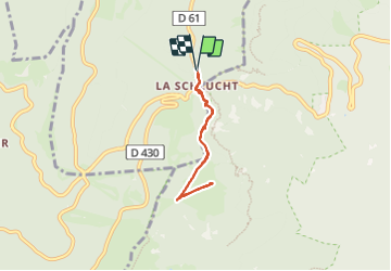

Length
5.1 km

Max alt
1247 m

Uphill gradient
143 m
Km-Effort
7 km

Min alt
1139 m

Downhill gradient
141 m
Boucle
Yes
Creation date :
2023-08-09 12:10:54.0
Updated on :
2023-08-10 10:29:40.505
1h47
Difficulty : Unknown

FREE GPS app for hiking
 SityTrail
IGN / Geographical institutes
SityTrail Plus
The world is yours!
About
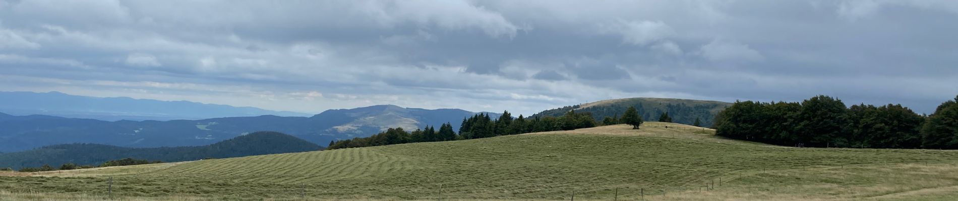
Trail Walking of 5.1 km to be discovered at Grand Est, Vosges, Le Valtin. This trail is proposed by FOUCAULT.
Description
9 Août 2023
Photos


Positioning
Country:
France
Region :
Grand Est
Department/Province :
Vosges
Municipality :
Le Valtin
Location:
Unknown
Start:(Dec)
Start:(UTM)
352670 ; 5325454 (32U) N.
Comments